Beyond the Beaten Path: Uncovering the Clyde's Forgotten Industrial Walking Routes
Photo: Uncredited, CC BY-SA 2.0, via Wikimedia Commons
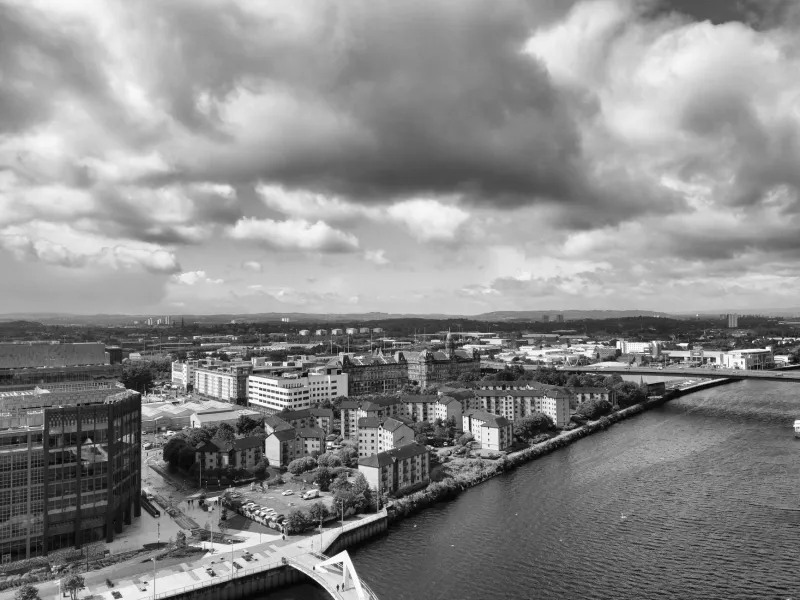
The Clyde is many things to many people. To the tourist arriving at Pacific Quay, it is a gleaming waterfront of museums and media centres. To the Glaswegian crossing the Squiggly Bridge on a grey Tuesday morning, it is simply part of the daily rhythm of the city. Yet beneath both impressions lies a far older and more layered landscape — one that reveals itself only to those willing to leave the main path and follow the river on its own terms.
The walking routes described here are not official trails. They carry no waymarker posts, no heritage plaques at every turn, and no café at the midpoint offering a restorative flat white. What they offer instead is something rarer: an unmediated encounter with the Clyde's industrial and social past, stitched together through cobbled lanes, overgrown embankments, and the kind of architectural details that reward a slow and curious eye.
The Govan Backstreets Loop
Govan is rightly celebrated for its Elder Park, its Pearce Institute, and the magnificent collection of early medieval carved stones housed in the Old Parish Church. But the neighbourhood's industrial skeleton is best understood by walking its quieter streets, away from the main thoroughfares.
Begin at Govan Cross and head south-west along Golspie Street, where the scale of the former shipyard boundary walls still imposes itself on the streetscape. These are not decorative structures; they were built to keep the workforce in and the outside world at a respectful distance. The rhythm of the working day was once governed entirely by what happened on the other side of these walls.
Continuing towards the river, walkers will find the remnants of a former engine works yard, its gate pillars still standing despite the clearance of everything around them. Local historians have documented this site as one of the last surviving examples of a mid-Victorian industrial entrance in the area, yet it receives virtually no formal recognition. Pause here and consider what it meant to pass through such a gate at five in the morning, six days a week, for the better part of a working life.
The loop concludes back at Govan Cross via Water Row, where a modest stone slipway — easily missed if you are walking quickly — marks the approximate location of one of the oldest river crossings on the Clyde. The ferry that once operated here connected Govan to Partick long before any bridge was contemplated.
The Rutherglen Riverside Trace
Few visitors to Greater Glasgow think to walk east along the Clyde towards Rutherglen, and that is precisely what makes this stretch so rewarding. The river here is quieter, the industrial archaeology more intact, and the sense of walking through genuinely unexamined territory more pronounced.
The route begins at Dalmarnock Bridge and follows the southern bank eastwards. Within the first half-mile, the walker encounters the concrete foundations of a former chemical works — an industry that once defined this stretch of the river and whose environmental legacy took decades to address. The regeneration of this corridor is ongoing, and the contrast between cleared land and surviving industrial fabric tells its own story about the pace and complexity of post-industrial recovery.
Further along, a small workers' memorial garden — established by a local community group in the early 2000s and now somewhat overgrown — commemorates those who lost their lives in the ironworks that once operated nearby. The memorial is modest almost to the point of invisibility, which perhaps reflects the broader difficulty of commemorating industrial labour in a culture that has historically privileged the products of that labour over the people who created them.
The route ends at Rutherglen Bridge, where the town's own industrial past — it was once a significant centre for paper-making and textile production — is recalled in a series of interpretive panels that, whilst not especially prominent, contain genuinely useful historical detail for the attentive visitor.
The Finnieston Grain Quarter
Finnieston has undergone one of the most dramatic transformations of any district along the Clyde waterfront, its former industrial identity now overlaid with restaurants, creative studios, and the cultural infrastructure of a post-industrial city. Yet the area's grain-handling past is more legible on foot than most of its newer residents appreciate.
The walk begins beneath the Finnieston Crane — that most iconic of Clyde landmarks — and moves westwards along the quayside. The crane itself is well documented, but the network of access roads, weighbridge housings, and former transit sheds that surrounds it is less frequently discussed. Several of these structures have been incorporated into the foundations of newer buildings, their original functions obscured but not entirely erased.
Heading inland along Minerva Street and its adjacent lanes, the walker enters what was once the operational hinterland of the grain trade: a dense grid of warehouses, stabling yards, and workers' housing that serviced the quayside operations. Much has been cleared or converted, but the street pattern itself preserves the logic of the original layout. The width of the lanes, the positioning of loading bays, the orientation of surviving buildings — all of these reflect decisions made by engineers and merchants in the mid-nineteenth century.
This route is perhaps the most urban of those described here, and the most useful for understanding how heritage and regeneration interact in real time. Walking it, one becomes acutely aware of what has been retained, what has been lost, and what has been consciously repurposed as a form of cultural memory.
Practical Guidance for Independent Walkers
None of the routes described above requires specialist equipment or significant physical fitness. All three are accessible by public transport, and each can be completed within two to three hours at a comfortable pace. Ordnance Survey maps of the relevant areas are recommended, as some sections pass through land that is not clearly marked on standard navigation applications.
Visitors are encouraged to approach these walks with an exploratory rather than a checklist mentality. The most significant discoveries along the Clyde's forgotten corridors are rarely the most obvious ones. A worn threshold stone, a blocked-up window at an unexpected height, a change in the texture of a boundary wall — these details accumulate into something more substantial than any single landmark could provide.
The river, as ever, rewards patience. It has been telling Scotland's story for centuries, and it is in no hurry to finish.
A Note on Access and Responsibility
Some sections of the routes described pass through areas that are privately owned or subject to ongoing development. Walkers should observe all posted notices and exercise appropriate caution in areas where ground conditions may be uneven or unstable. Where community groups or local heritage organisations have established interpretive materials along these routes, their work deserves acknowledgement and support.